Floods Hit Northwest and Southern China After Record Rainfall
For the past weeks, China has been hit by flooding around the northwestern Taklamakan Desert, one of the country’s driest regions, and record-breaking downpours across the south.
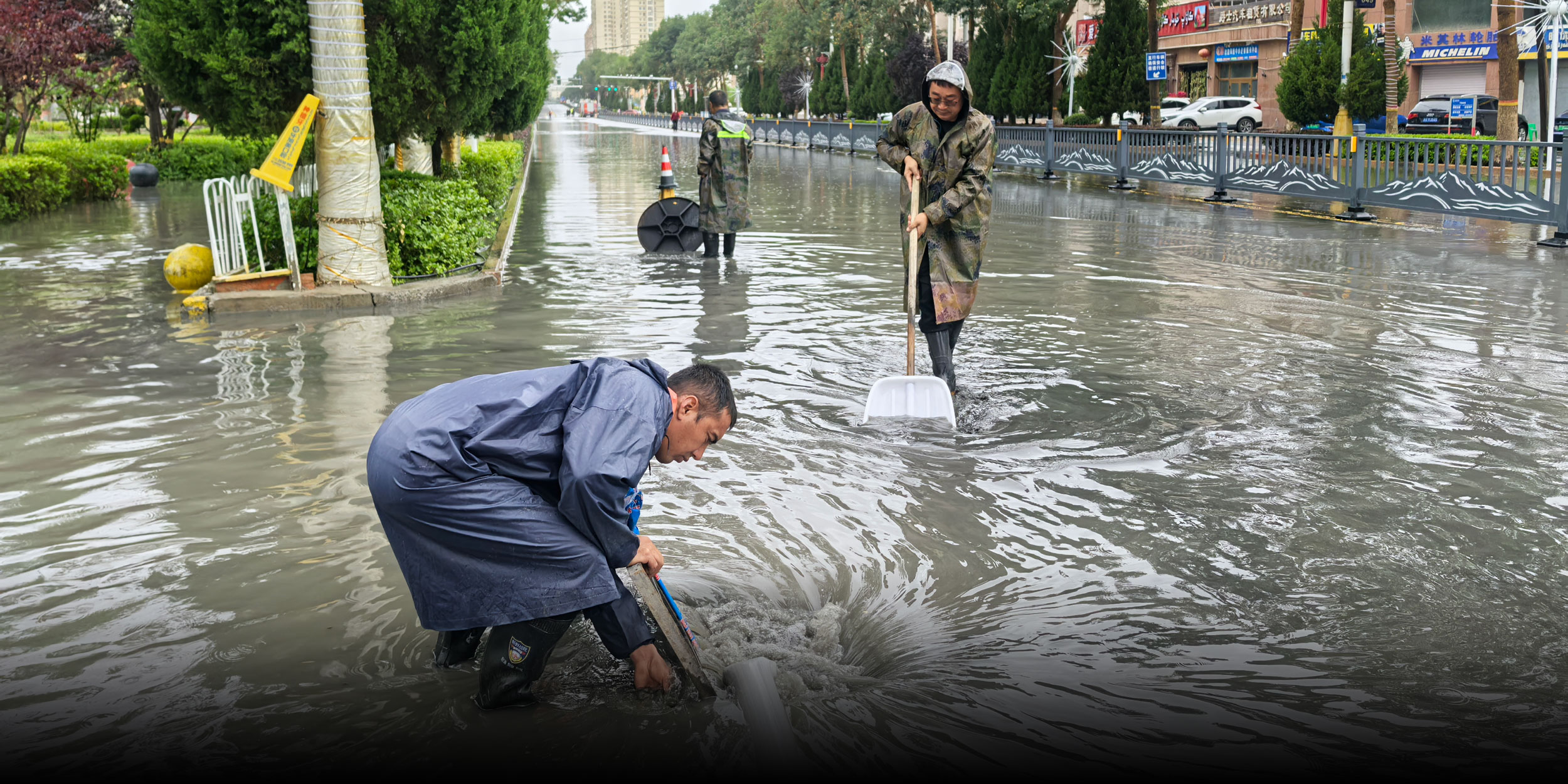
On June 20, Hotan, a city adjacent to the Taklamakan Desert in the northwestern Xinjiang Uyghur Autonomous Region, recorded rainfall exceeding its average annual precipitation in just hours, setting its highest-ever hourly rainfall. Video clips of the city’s flooded streets and mud-covered highways spread quickly online.
“We mainly get dust storms,” a resident surnamed Chen told domestic media. “This is the first time I’ve seen anything like this in the 12 years I’ve lived here.”
The downpour was caused by the convergence of two moisture streams over southern Xinjiang and the lifting effect of surrounding mountains, according to Xin Xin, chief meteorological analyst at Weather China, a forecasting platform affiliated with the China Meteorological Administration. Flash floods were further intensified by summer snowmelt from nearby mountains.
Xu Xiaofeng, president of the China Meteorological Service Association, told domestic media that while rainfall can help replenish water resources in arid regions, extreme precipitation can also overwhelm dry soils and trigger ecological disasters. “The problems caused by such extreme rainfall outweigh its benefits,” he said.
Southern China has also endured rounds of heavy rain. Since June 13, floods inundating towns and cities have prompted red alerts — the highest level — for rainstorms and broken local rainfall records. Between May 15 and 20, floods and related geological disasters due to torrential rainfall in the region left 82 dead or missing, according to the Ministry of Emergency Management.
Experts say the country needs to adapt to a wetter north. As global temperatures rise, China’s rain belts — or zones where rainfall is concentrated — have been moving westward and northward, bringing more frequent and intense rainfall to northern regions, Chen Lijuan, chief forecaster at the National Climate Center, said at a June 23 press conference.
Chen added that China’s humid and semi-humid climate zones — areas where rainfall is close to or greater than the amount of water lost through evaporation — have expanded by more than 300,000 square kilometers over the past five years compared with a standard set in the 1990s — an area roughly equivalent to the southwestern Yunnan province.
In recent years, sharp swings between drought and deluge and changing seasonal patterns have created new challenges for agriculture and disaster warning systems. This year, the risks are being compounded by El Niño, a naturally occurring climate pattern characterized by warming of the tropical Pacific Ocean’s surface.
On June 12, the National Climate Center said China is likely to experience more extreme weather events through August, following the onset of El Niño conditions in May. The center warned of flood risks in eastern regions, extreme heat waves in parts of central and eastern China, and an earlier typhoon season.
Editor: Marianne Gunnarsson.
(Header image: Municipal workers drain floodwater in Hotan prefecture, Xinjiang Uygur Autonomous Region, June 20, 2026. Hui Fenglei/Xinhua)